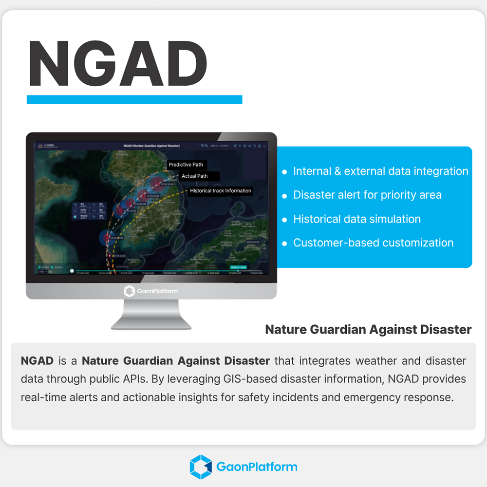


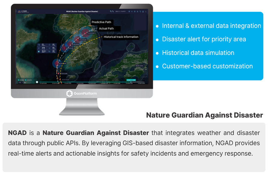
Nature Guardian Against Disaster
-
Payment
L/C(sight) , T/T
-
MOQ
1 ea
-
Supply Ability
9,999,999 ea per One-Time
-
Supply Details
Customization
Negotiable
-
Country of sale
Asia, Middle East, Europe, Americas, World Wide
-
PRICE
-
FOB
USD 35,000.00 ~ 70,000.00
(1 ea)
-
ITEM SPECIFICS
-
Brand
Model Nature Guardian Against DisasterAIVA v1.0
-
origin
Republic of Korea
-
Size(Capacity)
none
-
Function
Natural disaster monitoring system
-
Condition
Industrial software
-
Features
Provide S/W installation files in USB or CD format
PRODUCT DESCRIPTION
Nature Guardian Against Disaster
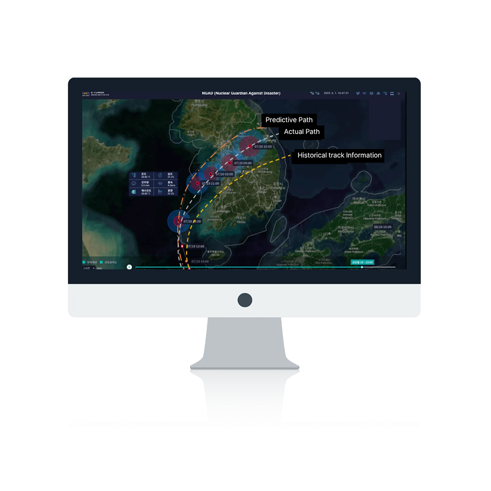
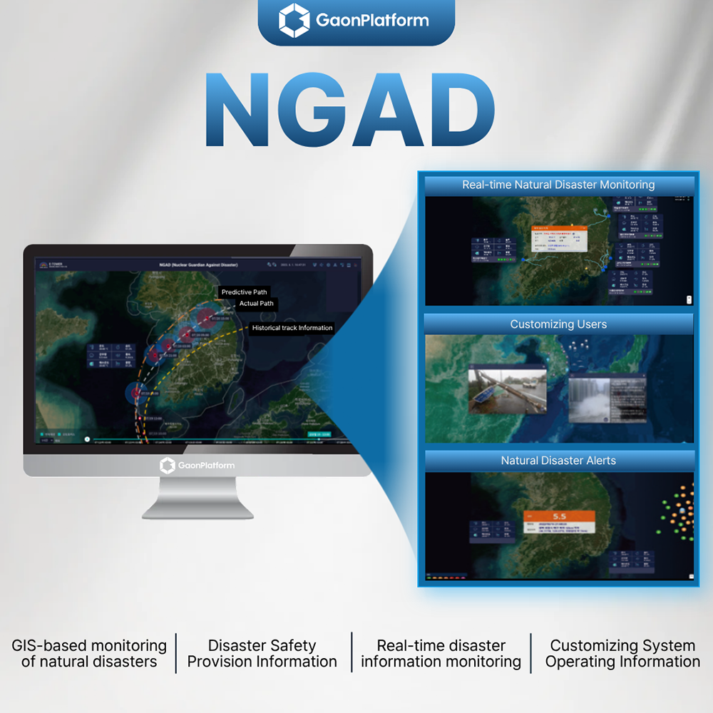
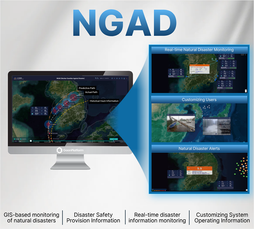
NGAD (Nuclear Guardian Against Disaster) v1.0 is a web browser-based system that uses GIS (Geographic Information System) maps to actively monitor the status of natural disasters, including wildfires, typhoons, earthquakes, and meteorological special reports.
When a natural disaster occurs, NGAD provides immediate situational awareness by displaying the disaster's location and meteorological information to the user. Critically, it visually represents the distance to key locations such as nuclear power plants, transmission lines, and transmission towers.
When a natural disaster occurs, NGAD provides immediate situational awareness by displaying the disaster's location and meteorological information to the user. Critically, it visually represents the distance to key locations such as nuclear power plants, transmission lines, and transmission towers.
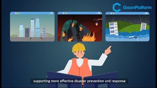
Key Benefits and Effects
• Real-Time Situational Awareness:
Enables organizations monitoring and controlling critical facilities to check real-time information related to disaster events.
• Rapid Alerting:
The system generates immediate x-alerts when a natural disaster occurs near a major facility, ensuring users are instantly aware of the event.
Core Features and Enhanced Functionality
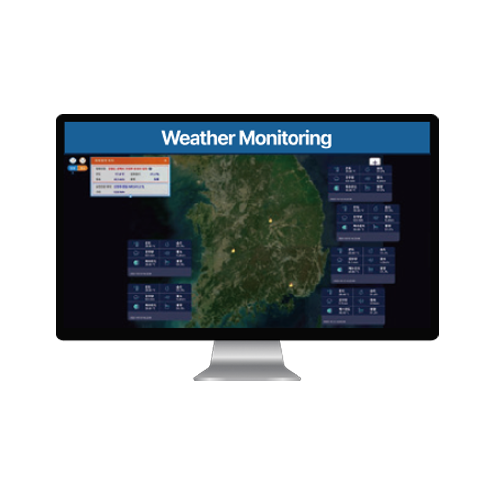
NGAD collects natural disaster information via OpenAPI from government agencies, including the Korea Meteorological Administration and the Korea Forest Service. All collected disaster information is displayed on a GIS map.
Wildfire Information Inquiry
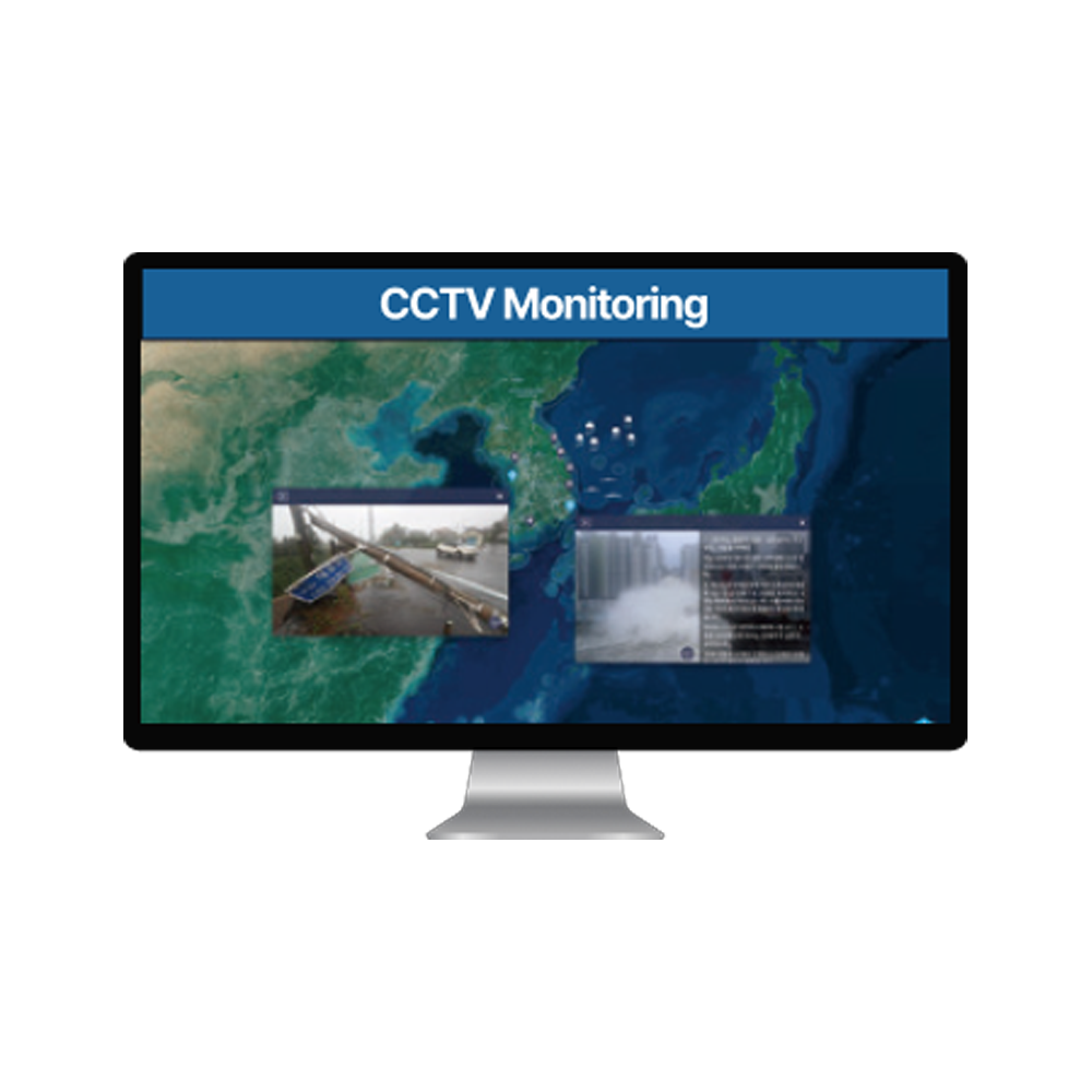
• Location and Distance Display:
When a wildfire occurs, the system displays the wildfire's location, especially those near major facilities, along with the distance to adjacent facilities.
• Situational Forecasts:
Based on the Korea Meteorological Administration's ultra-short-term forecast, NGAD shows wind data for 3 and 6 hours from the current time, along with the distance from the wildfire to nearby major locations.
• Alert Mechanism:
A wildfire x-alert message appears in a slide at the top of the screen, and a voice message is played. Pop-up windows provide the wildfire's start time, location, distance to adjacent facilities, and weather information.
Typhoon Information Inquiry
• Path and Scale Visualization:
Displays the typhoon’s scale, movement path, and projected path on the map.
• Impact Alerting:
An x-alert is triggered if major facilities fall within the typhoon's strong wind radius, both current and projected, after its formation. This x-alert also includes an audio message.
• Advanced Path Analysis:
- Expected Typhoon Path Inquiry: Displays the most recent forecast path and allows users to view past forecast paths.
- Similar Typhoons Inquiry: Enables searching for past typhoons that followed a similar path to the current one.
- Past Typhoon Simulation: Provides a simulation function that shows the typhoon's position and path change over time after it formed.
- Similar Typhoons Inquiry: Enables searching for past typhoons that followed a similar path to the current one.
- Past Typhoon Simulation: Provides a simulation function that shows the typhoon's position and path change over time after it formed.
Earthquake and Weather Alerts
• Earthquake Monitoring:
Collects and displays information on earthquakes that occurred near major facilities, showing the location and distance from those facilities. Pop-ups provide the time, location, intensity, magnitude, and distance to nearby facilities.
• Meteorological Special Reports:
When a weather advisory is issued, its details appear, and the affected area is shown on the map with an animation and an audio message plays.
Company Overview
Gaon Platform Inc. is an AI-based software development company incorporated in Daedeok Research Complex in Daejeon.
Using IoT measurement sensor data and image data, facility failures and safety accidents are predicted and prevented in advance,
Experience optimal processes and maintenance strategies by predicting facility performance and life expectancy.
We will do our best to provide the best technology and the best engineering services
Other Products
R&D CERTIFICATE
-
- Designation as a high-tech company
- Ministry of Science and ICT
- 2024.01.19
- 인증서보기
PAYMENTS DETAILS
This supplier supports payments for offline orders
- Letter of Credit : L/C(sight)
- Telegraphic Transfer : T/T
- Name : Thomas Lee
SHIPPING
Shipping from :
Republic of Korea
- 74 Techno jungang-ro, Yuseong-gu, Daejeon (34018)
GaonPlatform Inc.
The person in charge
Man Young ChoAddress
74 Techno jungang-ro, Yuseong-gu, Daejeon (34018)
QR
GaonPlatform Inc.
Introduction
Gaon Platform Inc. is an AI-based software development company incorporated in Daedeok Research Complex in Daejeon.
Using IoT measurement sensor data and image data, facility failures and safety accidents are predicted and prevented in advance,
Experience optimal processes and maintenance strategies by predicting facility performance and life expectancy.
We will do our best to provide the best technology and the best engineering services
-
- Business Type :
- Other
-
- Main Product :
- IPCM v10, SSSS v30, AIVA
-
- Established :
- 2019-03-01
-
- Total Annual Revenue :
-
- Total Employees :
- 11~50 people
R&D CERTIFICATE
-
- Certificate of software Quality
- ktl
- 2023.04.21
- 인증서보기
-
- Performance Certificate
- Ministry of SMEs and Startups
- 2023.08.21
- 인증서보기
-
- Certificate of software Quality
- ktl
- 2024.03.29
- 인증서보기
-
- Certificate of KISA
- Korea Internet & Security Agency
- 2023.06.30
- 인증서보기
-
- Designation as a high-tech company
- Ministry of Science and ICT
- 2024.01.19
- 인증서보기
-
- Certificate of software Quality
- ktl
- 2022.12.30
- 인증서보기
-
- Certificate of Designation of Excellent Product
- Public Procurement Service
- 2024.12.16
- 인증서보기
COMPANY ENVIRONMENT

Please suggest a variety of your ideas such as design, impact, enhancements, etc
Captcha Required
Please enter the text on the left image to prevent automatic input.
0 / 4000
질문이 없습니다.
CUSTOMER REVIEWS (0)

TRADE EXPERIENCE
-
- Total revenue
-
- Total export revenue (previous year in USD)
-
- Number of foreign trade employees
- 11~50 people
COMPARISON TO SIMILAR ITEMS more
- No Items
- supplier level
- MEMBER
- GaonPlatform Inc. Seller's Store
- Seller's Store url
- Response Level
★ ★ ★ ★ ★

- Supplier Level
★ ★ ★ ★ ★
- Transaction Level
★ ★ ★ ★ ★
SUPPLIER BEST